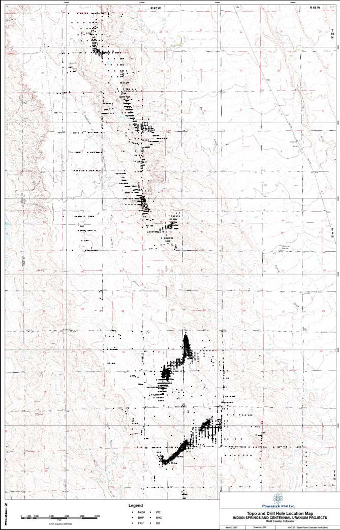
3,500 old drill holes exist within mining area
Abandoned holes may provide pathways for migration of contaminated water
Posted September 2, 2007
Excerpts from Report on the Centennial Project, Weld County, Colorado - Voss & Gorski - March 28, 2007 (pdf):
Following the original uranium discovery in Weld County in 1969, RME (Rocky Mountain Energy) began exploring the Cheyenne Basin by conducting a reconnaissance program consisting of outcrop examinations, water sampling, and radon soil survey...
Exploration drilling between 1977 and 1979 delineated uranium ore bodies at depths of 250-600 feet in the northern portion of the project and at depths of 85-125 feet to the south. RME focused on the southern shallow deposits, with a plan to develop a surface mining operation...
RME’s database, including 3,500 drill holes, has been retained in the files acquired by Powertech from Anadarko (Anadarko Petroleum Corporation). Figure 5 shows the extent of drilling within the Centennial Project boundaries...
...Potential pathways for hydraulic communication can include improperly plugged, completed, or abandoned wells that penetrate both the injection zone and fresh water zones. Figure 111-5 shows an example of fluid from the injection zone migrating upward into a fresh water aquifer through an unplugged well that penetrates the injection zone within the zone of endangering influence created by the injection operation. In this case migration occurs through the available pathway because the initial pressure of the fluid in the injection zone at the location of the pathway was raised higher than the water level in the fresh water aquifer...
...Wells of all kinds -- producing or abandoned -- that penetrate the injection zone within the AOR (Area of Review) have the potential to become pathways for migration. Whether or not they will, in fact, leak, is a function of how the wells were constructed and/or plugged...
...Locating possible pathways in which migration could occur, within an established AOR, is an important concept of the UIC (Underground Injection Control) regulations. Unfortunately, circumstances can make a realistic application of this concept difficult. For example, the location and exact status of abandoned wells may be difficult to ascertain; or there may be little confidence in completion and plugging records. These types of problems are not surprising, considering that the review process includes wells that were drilled, completed, and abandoned before adequate record keeping systems were established. Intuitively, it can be expected that in areas where there are older wells there will be an increase in the need for corrective action simply because of the methods of construction and abandonment that prevailed in earlier years. Identifying problem wells that may provide a pathway for contaminants can be a major problem to deal with when adequate information on these wells is not available...
...Once the AOR has been delineated, all
potential pathways that may allow migration to occur should be identified
during this step. All known wells that penetrate the injection zone within
the AOR are required to be identified and the records of these wells checked
to determine if any were improperly completed and/or abandoned. Several
problems could be encountered when applying this step. First, there may be
unidentifiable pathways or wells with little or no information on their
completion or abandonment. Second, available records
may be inaccurate, incomplete or otherwise questionable...
Topo and Drill Hole Location Map - Indian Springs and Centennial Uranium Projects - Weld County, Colorado - Powertech (USA) Inc.